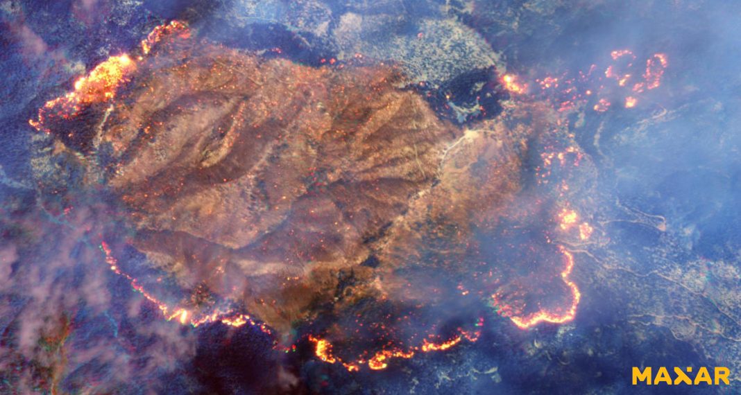
The recent wildfires in California have caused unprecedented devastation, with satellite images providing a stark and detailed view of the scale of destruction. The images, captured by NASA’s Earth Observing System, show the extent of the damage across vast swathes of Los Angeles and its neighboring areas. The fires, fueled by strong winds and dry conditions, have forced thousands to evacuate and resulted in significant environmental and economic losses.
Impact Revealed by Satellite Technology
Satellite imagery has played a crucial role in assessing the severity of the wildfires. High-resolution photos from the MODIS (Moderate Resolution Imaging Spectroradiometer) and VIIRS (Visible Infrared Imaging Radiometer Suite) sensors show dense plumes of smoke extending across the Pacific Ocean, indicating the sheer intensity of the fires. Infrared imaging has helped track the hotspots, aiding firefighters in strategizing their containment efforts.
The images also reveal vast areas of charred land, with some regions experiencing complete deforestation. Urban areas have not been spared, as neighborhoods in Pacific Palisades, Pasadena, and Sylmar appear significantly impacted, with many structures reduced to ash.
Wildlife and Environmental Concerns
The satellite data also highlight the ecological impact of the fires. Large sections of wildlife habitats have been destroyed, with local species such as deer, coyotes, and various bird species displaced from their natural environments. NASA’s Earth Science Division reported significant air quality deterioration, with smoke and particulate matter spreading to neighboring states.
Response and Ongoing Challenges
California’s emergency teams are utilizing the satellite images to coordinate relief and containment measures. The visual data have been pivotal in monitoring the spread of the fires and identifying areas most in need of assistance. However, the unpredictable weather conditions and strong winds continue to hamper efforts.
Looking Ahead
The satellite images not only underline the immediate impact of the wildfires but also emphasize the long-term challenges posed by climate change. Experts believe that the increasing frequency and intensity of such fires are a direct result of rising global temperatures and prolonged drought conditions.
The integration of advanced satellite technology in wildfire management has proven invaluable, but it also serves as a reminder of the urgent need for comprehensive climate action to mitigate future disasters.
BY – NIKITA


